
Indonesia Issues Tsunami Warning After 7.7 Magnitude Earthquake Near Flores Island
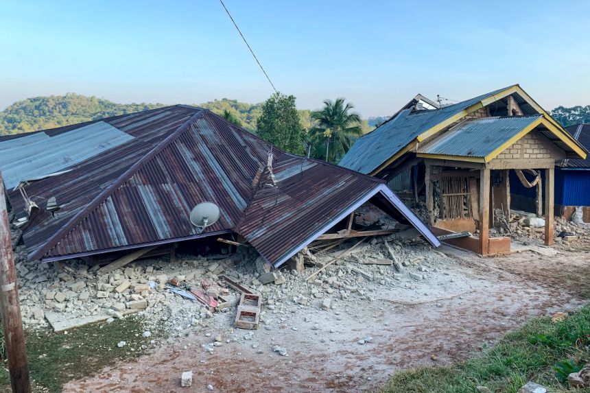
On 15 August 2026 at 5:58 AM local time, a strong earthquake measuring 7.7 in magnitude struck off Flores Island, Indonesia. The United States Geological Survey (USGS) reported it as a shallow earthquake at a depth of 10 kilometres, with an epicentre about 68 kilometres north-northwest of Ende. Following the quake, Indonesia's Meteorology, Climatology, and Geophysics Agency (BMKG) issued tsunami warnings for East Nusa Tenggara, South Sulawesi, and West Nusa Tenggara which were later lifted after tide gauges recorded wave changes of less than one metre. The earthquake caused at least two fatalities and multiple injuries, along with structural damage across Flores Island. Multiple aftershocks were recorded, the largest being magnitude 6.1.
On this page
Key Facts
- Date and Time: 15 August 2026, 5:58 AM local time
- Magnitude: 7.7 (measured by USGS)
- Depth: 10 kilometres (classified as a shallow earthquake)
- Epicentre: Approximately 68 kilometres north-northwest of Ende, near Flores Island in the Lesser Sunda Islands region
- Tsuanmi Warning Issued By: BMKG (Indonesia’s Meteorology, Climatology, and Geophysics Agency)
- Areas Under Tsunami Warning: East Nusa Tenggara, South Sulawesi, West Nusa Tenggara
- Fatalities and Injuries: At least two deaths and several injuries reported around L Say Maumere port
- Structural Damage: Collapse of Pelni port terminal waiting room in Maumere and roof damage at St. Peter Major Seminary in Sikka
- Aftershocks: Multiple recorded, largest measuring magnitude 6.1
- Tsunami Warning Lifted: After tide gauges recorded wave changes under one metre
Background & Context
Indonesia lies within the Pacific Ring of Fire, a major area in the basin of the Pacific Ocean where numerous earthquakes and volcanic activities occur due to tectonic plate boundaries. It sits near the convergence of the Indo-Australian, Eurasian, and Pacific tectonic plates, making it highly prone to seismic hazards. Flores Island, part of East Nusa Tenggara province, is situated in eastern Indonesia, an area with repeated seismic activity. The BMKG monitors weather and seismic activity to provide warnings such as tsunami alerts to mitigate disaster risks. The USGS is a United States federal agency that monitors earthquakes and other geological hazards worldwide.
Why This Matters for Exams / Exam Relevance
Understanding the tectonic setting of Indonesia, earthquake measurement and terminology, and disaster management agencies like USGS and BMKG is important for competitive examinations. Questions on natural disasters, hazard management, and geography of the Pacific Ring of Fire are common. Awareness of recent events helps in answering current affairs and geography questions. Knowledge about tsunami warning protocols and causes of undersea quakes enriches understanding of hazard mitigation.
Points to Remember
- Indonesia's position on the Pacific Ring of Fire causes frequent seismic and volcanic activities.
- The 7.7 magnitude earthquake on 15 August 2026 was a shallow event at 10 km depth located near Flores Island.
- BMKG issued tsunami warnings for multiple provinces which were lifted after minimal wave activity was detected.
- At least two deaths and several injuries occurred, along with structural damages in Maumere and Sikka areas.
- Multiple aftershocks followed, the largest being magnitude 6.1.
- USGS is the US federal agency responsible for monitoring global earthquakes, and BMKG is Indonesia’s meteorological and seismic monitoring agency.
Sources & Further Reading
| Document / Website | Link |
|---|---|
| Indonesia Issues Tsunami Warning After Flores Quake - GKToday | Open Indonesia Issues Tsunami Warning After Flores Quake - GKToday ↗www.gktoday.in |
| USGS - Earthquake Facts and Information | Open USGS - Earthquake Facts and Information ↗www.usgs.gov |