
INSAT-3DR: India's Crucial Meteorological Satellite for Weather Forecasting and Disaster Management
INSAT-3DR, launched on 8 September 2016 via GSLV-F05, is a vital Indian geostationary meteorological satellite. Equipped with a 6-channel imaging payload and a 19-channel atmospheric sounder, it provides half-hourly real-time multispectral data for weather forecasting, cyclone tracking, monsoon analysis, and disaster management over India and adjoining regions. Since September 2020, after the INSAT-3D atmospheric sounder ended service, INSAT-3DR has been the primary source of hourly atmospheric sounding data for the INSAT-3 system. The satellite also carries a Search and Rescue Transponder, aiding in rescue operations. Its capabilities include measuring ocean surface temperatures and cloud characteristics, supporting the India Meteorological Department and other operational users.
On this page
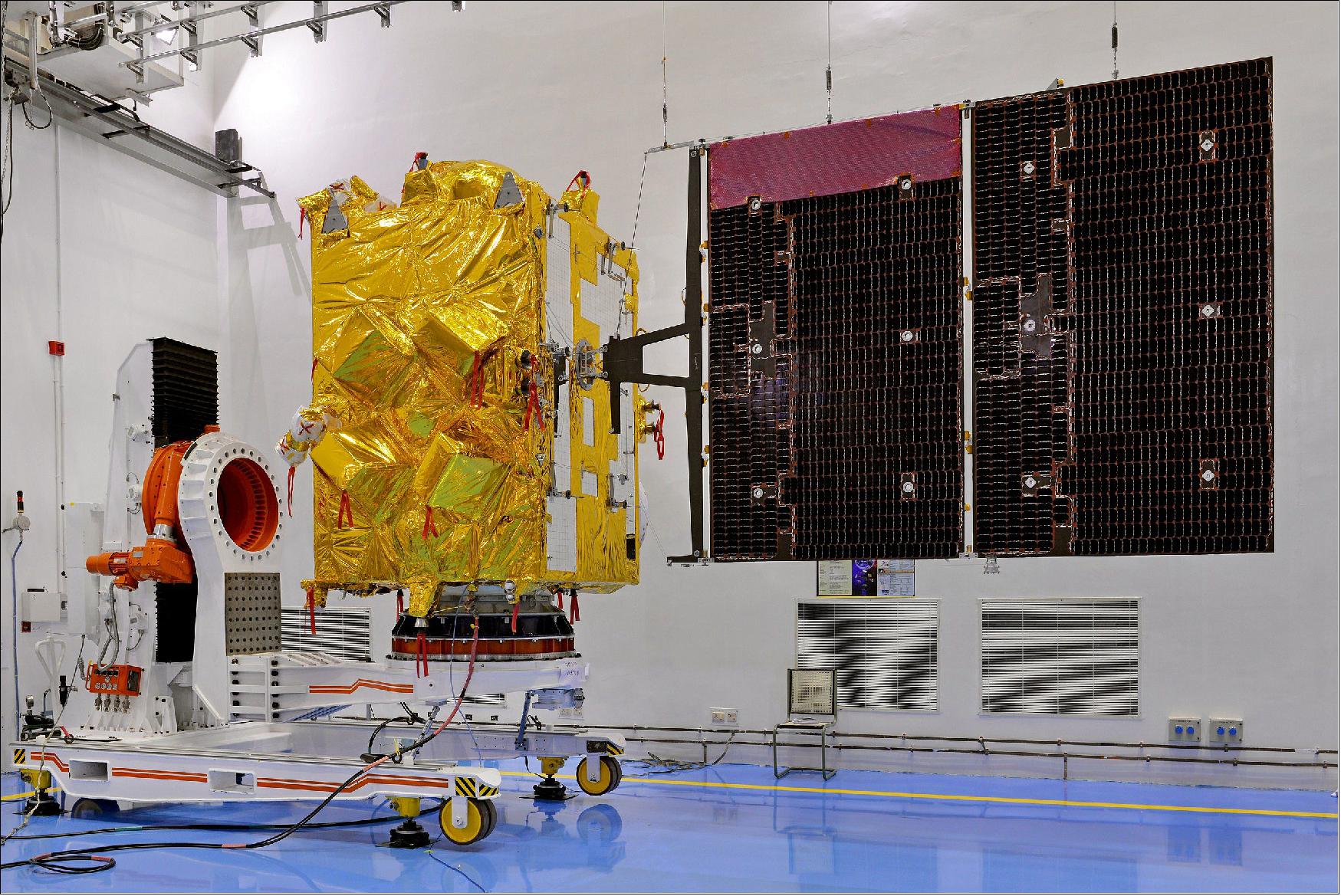
Key Facts
- INSAT-3DR was launched on 8 September 2016 aboard GSLV-F05 from India.
- It operates in a geostationary orbit approximately 35,786 kilometres above the Earth's equator, remaining fixed relative to the Earth's surface.
- The satellite carries a 6-channel multi-spectral imager and a 19-channel atmospheric sounder.
- It provides half-hourly multispectral images over the Indian region.
- The imager includes middle infrared capability for detecting night-time low clouds and fog and thermal infrared bands for sea surface temperature estimation.
- The 19-channel atmospheric sounder measures the vertical structure of the atmosphere.
- INSAT-3DR also carries a Data Relay Transponder and a Search and Rescue Transponder, which supports emergency services in the region.
- After the INSAT-3D satellite's atmospheric sounder ended service in September 2020, INSAT-3DR became the primary source of hourly atmospheric sounding data in the INSAT-3 system.
- Its data supports cyclone tracking, rainfall estimation, monsoon cloud band analysis, nowcasting, and continuous meteorological inputs for the India Meteorological Department (IMD) and other users.
- Satellite imagery from INSAT-3DR is especially used to track cloud systems during the Indian monsoon over regions including western India, eastern India, Gujarat, south Rajasthan, and northwest Maharashtra.
Background & Context
INSAT-3DR is part of India’s INSAT-3 series, which forms a multipurpose satellite system for communication, broadcasting, meteorology, and search and rescue operations. The INSAT system has been a backbone for India’s space-based meteorological observations and services. INSAT-3DR succeeded INSAT-3D’s functions in atmospheric sounding and imaging after INSAT-3D’s atmospheric sounder ceased functioning in September 2020.
Operating from geostationary orbit allows continuous and real-time monitoring over the Indian subcontinent and adjoining oceanic regions. This capability is vital for tracking developing weather phenomena, issuing timely warnings for cyclones and floods, and managing disaster response effectively.
The payloads onboard INSAT-3DR—multi-spectral imager and atmospheric sounder—collect data essential for understanding atmospheric temperature and moisture profiles, cloud cover, and ocean surface temperature. The Search and Rescue Transponder complements India's disaster management efforts by aiding in search and rescue operations during emergencies.
Why This Matters for Exams / Exam Relevance
INSAT-3DR is an important topic for competitive exams in India, especially in sections related to science and technology, environment, and Indian space programs. Key points include its launch details, payload capabilities, operational significance, and role in enhancing India's weather forecasting and disaster management systems.
Understanding the functionality and importance of satellite meteorology, especially INSAT-3DR's role in cyclone tracking, rainfall estimation, and monsoon monitoring, reflects India's technological advances in managing its complex climatic challenges. Awareness of its Search and Rescue Transponder also highlights India's preparedness for disaster mitigation.
Points to Remember
- Launch date: 8 September 2016.
- Launch vehicle: GSLV-F05 from India.
- Orbit: Geostationary orbit at approx. 35,786 km altitude above equator.
- Payloads: 6-channel multi-spectral imager, 19-channel atmospheric sounder, Data Relay Transponder, Search and Rescue Transponder.
- Provides half-hourly multispectral images and hourly atmospheric profile data.
- Primary provider of atmospheric sounding data after INSAT-3D's sounder ended service in September 2020.
- Supports the India Meteorological Department and other operational users for nowcasting, cyclone monitoring, monsoon analysis, rainfall estimation, and disaster management.
- Includes night-time imaging capabilities (middle infrared) for detecting low clouds and fog and thermal infrared bands for sea surface temperature measurements.
- Assists in search and rescue operations via its Search and Rescue Transponder.
Sources & Further Reading
| Document / Website | Link |
|---|---|
| INSAT-3DR remains crucial for weather forecasting | Open INSAT-3DR remains crucial for weather forecasting ↗www.gktoday.in |
| India Meteorological Department - Official Website | Open India Meteorological Department - Official Website ↗mausam.imd.gov.in |
| Indian Space Research Organisation (ISRO) - INSAT Satellite System | Open Indian Space Research Organisation (ISRO) - INSAT Satellite System ↗www.isro.gov.in |