
LiDAR Survey and Archaeological Mapping at Lakkundi, Karnataka
The Department of Archaeology, Museums and Heritage (DAMH), Karnataka, in collaboration with the National Institute of Advanced Studies (NIAS), Bengaluru, is undertaking a six-month project using LiDAR, GIS, remote sensing, and Ground Penetrating Radar to locate and map buried monuments from the 10th to 12th century Kalyana-Chalukya period at Lakkundi, Gadag district. This project aims to verify local folklore about '101 wells and 101 temples' scientifically, uncover hidden structures, and aid heritage preservation efforts including plans for a state-protected open-air museum.
On this page
Key Facts
- Lakkundi is located in Gadag district, Karnataka.
- A six-month LiDAR and geospatial mapping survey commenced in 2026 under an MoU signed on August 27, 2026, between DAMH Karnataka and NIAS Bengaluru.
- The project utilizes non-invasive techniques including LiDAR, Geographic Information System (GIS) mapping, remote sensing, Ground Penetrating Radar (GPR), drone documentation, and photogrammetry to detect buried structures.
- These technologies help identify subsurface features such as buried walls and landscape patterns without excavation.
- The area is historically significant as a prominent urban center of the Western Chalukya (Kalyana-Chalukya) era dating from the 10th to 12th centuries CE.
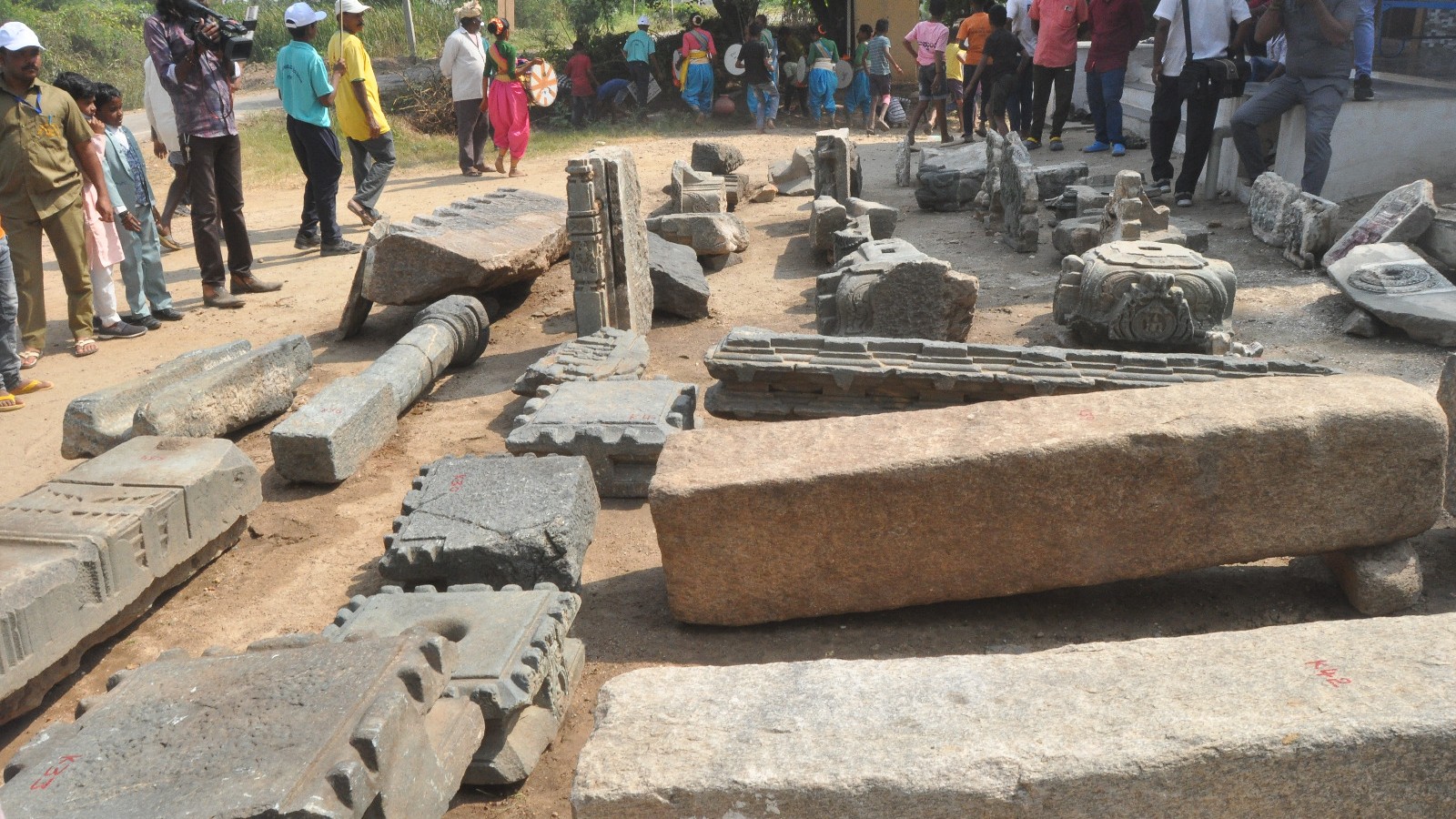
- Local tradition speaks of '101 wells and 101 temples'; authorities have identified 70 monuments so far in Lakkundi, including 32 temples, 28 stepwells (pushkarni), and other structures.
- Excavations have yielded over 3,300 artefacts across two phases (Phase 1: 1,500+ artefacts; Phase 2 began May 2, 2026).
- The Karnataka government plans to provide state protection to 44 heritage sites within Lakkundi and proposes a three-acre open-air museum to document and display more than 5,000 expected artefacts, targeted for completion by June 30, 2026.
- Excavations at Kote Veerabhadreshwar Temple in Lakkundi revealed Neolithic artefacts, such as stone axes and grey clay pots, extending the known history of the site beyond the medieval period.
Background & Context
Lakkundi was an important city during the Western Chalukya dynasty, known for its temple architecture, stepwells, and inscriptions. The Western Chalukya (Kalyana-Chalukya) architecture is noted for blending Dravidian and Nagara styles, characterized by ornate ornamentation, star-shaped (stellate) temple plans, soapstone construction, and the presence of both Shaiva and Vaishnava motifs. The temples of Lakkundi reflect this style and cultural heritage. Scientific documentation using modern technologies like LiDAR, GIS, and GPR allows researchers to locate hidden structures presumed buried under vegetation or soil, offering precise mapping crucial for conservation and further research.
Why This Matters for Exams
The Lakkundi LiDAR survey exemplifies the use of cutting-edge technology in archaeology, promoting heritage conservation and enriching understanding of medieval South Indian history and architecture. Candidates preparing for exams related to Indian history, archaeology, or cultural heritage should recognize the importance of such interdisciplinary approaches. The survey highlights Karnataka’s deep cultural history, reflecting the socio-political and architectural advancements during the Western Chalukya period. Awareness about LiDAR and its applications in archaeology is particularly relevant for contemporary exam syllabi centered on heritage management and scientific methods in archaeology.
Points to Remember
- LiDAR (Light Detection and Ranging) is a remote sensing technology that uses laser pulses to create highly detailed 3D maps and detect buried or obscured structures.
- The Western Chalukya period (10th-12th centuries CE) is known for the development of distinctive temple architecture and urban centers like Lakkundi.
- Lakkundi is famed for temples, stepped wells (pushkarni), and inscriptions, though many monuments remain hidden or buried.
- The DAMH and NIAS collaboration commenced with an MoU on August 27, 2026, to apply scientific techniques including LiDAR, GIS, GPR, and photogrammetry in archaeological exploration.
- 70 monuments have been identified: 32 temples, 28 wells, and others, supporting local folklore about '101 wells and 101 temples'.
- Excavations are ongoing; phase one uncovered over 1,500 artefacts, and phase two started May 2, 2026.
- Karnataka government aims to protect 44 heritage sites and develop a 3-acre open-air museum for artefact display by June 30, 2026.
- Neolithic artefacts found at Kote Veerabhadreshwar Temple expand the archaeological significance of Lakkundi beyond medieval times.
Practice MCQs
Question 1
- When was the MoU between the Department of Archaeology, Museums and Heritage (DAMH), Karnataka and the National Institute of Advanced Studies (NIAS) signed for the Lakkundi LiDAR survey?
- A) August 27, 2025
- B) August 27, 2026
- C) June 30, 2026
- D) May 2, 2026
Answer: B) August 27, 2026
Question 2
- Which technology is NOT mentioned as being used in the archaeological survey of Lakkundi?
- A) LiDAR
- B) Ground Penetrating Radar (GPR)
- C) Satellite GPS navigation
- D) Photogrammetry
Answer: C) Satellite GPS navigation
Question 3
- How many monuments, including temples and wells, had been identified at Lakkundi through the survey as of 2026?
- A) 44
- B) 70
- C) 101
- D) 32
Answer: B) 70
Sources & Further Reading
| Document / Website | Link |
|---|---|
| LiDAR Survey to Map Hidden Monuments at Lakkundi – GKToday | Open LiDAR Survey to Map Hidden Monuments at Lakkundi – GKToday ↗www.gktoday.in |
| LiDAR survey to look for Lakkundi’s hidden monuments - The Hindu | Open LiDAR survey to look for Lakkundi’s hidden monuments - The Hindu ↗www.thehindu.com |
| Western Chalukyas, Rulers, Architecture, Literature, UPSC Notes | Open Western Chalukyas, Rulers, Architecture, Literature, UPSC Notes ↗vajiramandravi.com |
| Neolithic relics found during excavation at Lakkundi - The Hindu | Open Neolithic relics found during excavation at Lakkundi - The Hindu ↗www.thehindu.com |